Fenland Landscape Survey
Help us to map the historic landscape of the Lincolnshire Fens
We’re thrilled as we set out to explore the mysteries of the fenland landscape and delve into its transformation and influence by humans since the last Ice Age. By analysing a blend of ancient maps, photographs, and documentary sources, we aim to chart the captivating history of this distinctive and frequently underestimated landscape, comprehending its evolution throughout the ages.
Read on to find out more and see how you can get involved …
* Beta version, not supported in some browsers
Why the Lincolnshire Fens?
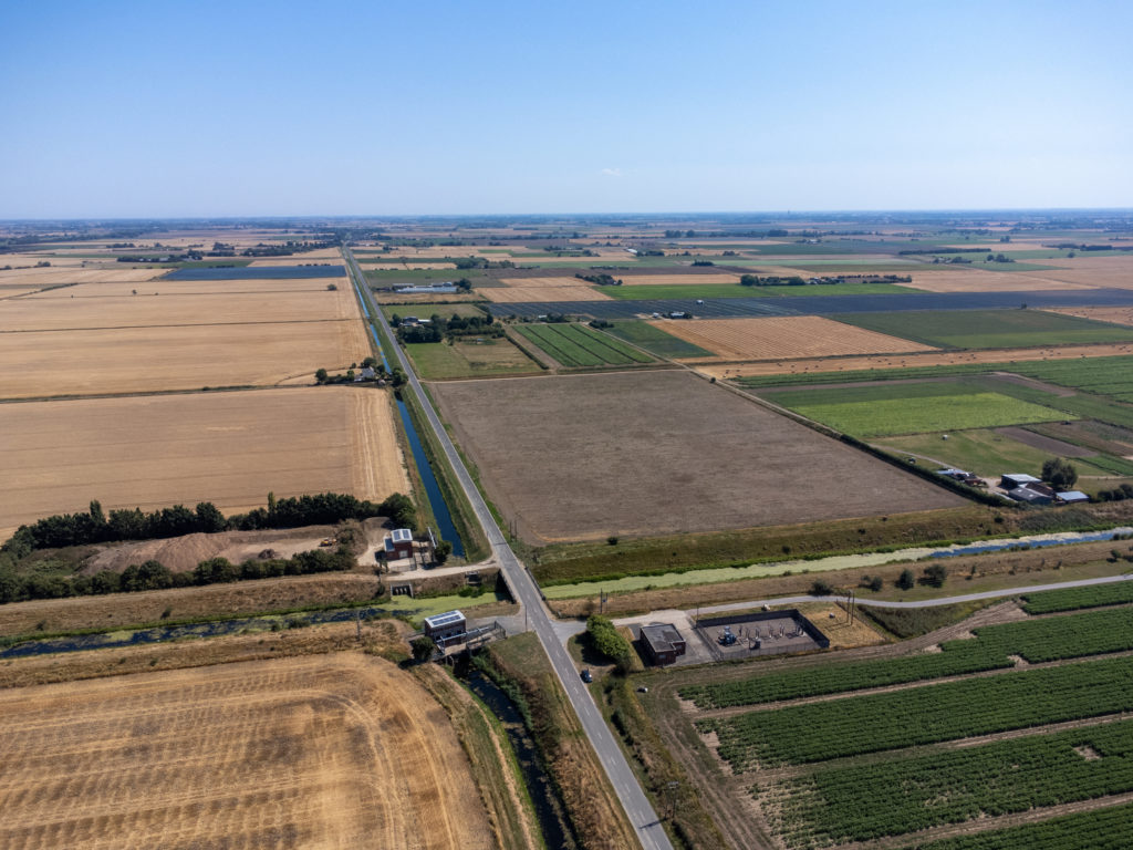
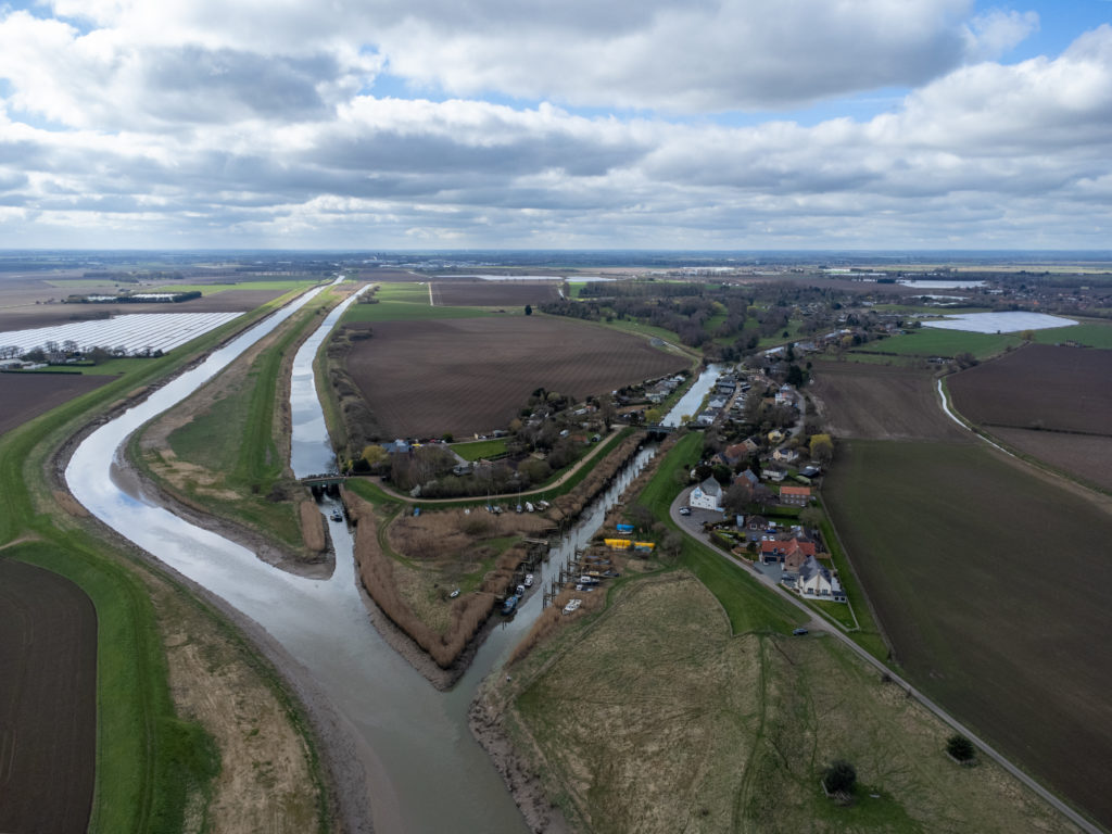
The Lincolnshire Fens, known as Holland, is a unique and fragile landscape that has played a significant role in shaping the history and culture of the local area for over 4,000 years. However, it has received less research attention compared to its surroundings, resulting in a limited understanding of its unique characteristics among researchers.
Typically, when people think of the Fens, sites like Must Farm and Flag Fen in Cambridgeshire come to mind, but the silt fen landscape in Lincolnshire has distinct features that require further exploration and promotion.
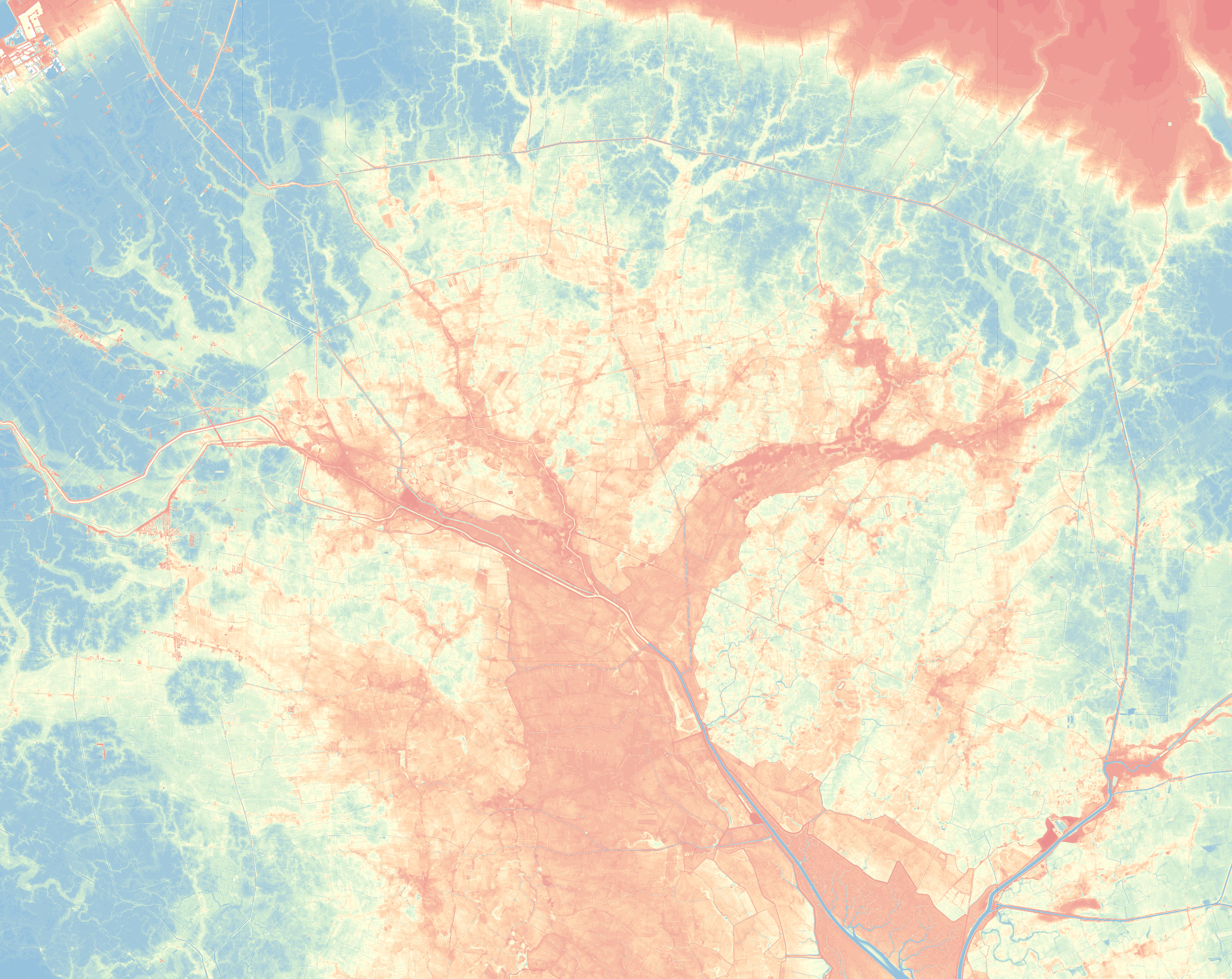
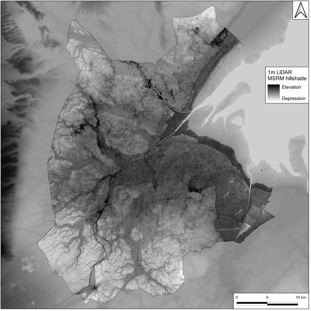
Aerial photographs are a great way to begin identifying archaeology in a landscape however, Historic England’s National Mapping Programme doesn’t cover the Fens. In fact, the last time a detailed study of the historic landscape was carried out was 30 years ago as part of the Fenland Management Project.
Digital techniques have advanced considerably since then, enabling greater collaboration between researchers and volunteers, and access to large, publicly accessible datasets. Much of this work can even be done online for free in the comfort of your own home, such as using Google Maps and the National Library of Scotland.
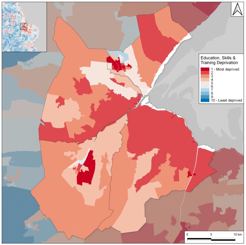
Unfortunately the East Midlands – South Lincolnshire in particular – falls well behind the national average when it comes to digital literacy. Data collected by the Office for National Statistics for English Indices of Deprivation 2019 highlights the lack of educational attainment, skills and training in the local population.
What do we plan to do?
The main aim of this project is to train local participants of all ages and backgrounds in transferable digital skills needed to gain a comprehensive understanding of the Fens’ rich and complex heritage. We want to show that learning doesn’t end when formal education finishes.
The Fenland Landscape Survey will engage local volunteers of all ages to help map and interpret the historic landscape of South Lincolnshire, making the data open and accessible for all. By utilizing a variety of techniques (new and old), we can gain a better understanding of this complex and dynamic landscape’s history.
Activities include digitisation and interpretation of historic maps and aerial images, toponomastics (a study of the history and meaning of place names), and archaeological landscape survey techniques.
The project will benefit from the involvement of both volunteers and professional archaeologists, providing a diverse range of perspectives and expertise. Workshops will be delivered to local interest groups as well as primary and secondary school children within the project area.
With the help of these diverse research methods, the project aims to safeguard the Fens’ cultural and natural heritage for future generations.
What will this work achieve?
The main purpose of the project is for the local community to have contributed to a better understanding of the history of South Lincolnshire while improving their digital skills. This will benefit the local area by fostering a sense of identity, pride, and connection among participants and its residents. By delving into and preserving the historical, cultural, and social aspects of the community, such a project can create a shared understanding of the area’s roots and evolution. This awareness promotes a stronger sense of belonging and can lead to increased community engagement and cooperation.
Future Opportunities
We’re going beyond the desk and will be offering future opportunities in the following:
We’re aiming to follow up on the key sites we’ve identified through our mapping project to: better understand the geology through a programme of test pitting and hand augering; discover artefacts in the ploughsoil through fieldwalking; use geophysical survey to reveal buried archaeological features, and excavate newly discovered sites!